What Is a Drone Survey? Types, Costs and When You Need One
Everything you need to know before booking one: the six main types, how a survey actually happens, honest pricing from the UK and Cyprus markets, and — just as important — what a drone survey can't do.
AD
Adam Dankhazi
Founder & Chief Remote Pilot
A drone survey is the capture of detailed data about land or buildings using a camera-equipped drone (UAV) instead of ground-level access. The output can be high-resolution photos and video, stitched orthomosaic maps, elevation models or close-range inspection imagery — collected in a fraction of the time it takes with ladders, scaffolding or a walk-over, and with nobody leaving the ground. If you're weighing one up, this guide covers the types, the process, real prices and the honest limits.
What is a drone survey?
In practical terms, a drone survey means a licensed pilot flies a pre-planned route over or around your site, capturing hundreds of precisely positioned images or video frames. Software then turns that raw capture into something useful: a set of graded photos, a measurable map, a condition report on a roof, or a month-by-month record of a construction project.
The word "survey" here is used the way most UK property people use it — a systematic inspection or measurement exercise. In the US, the same work is more often called drone mapping or aerial mapping, because "survey" in American usage usually means a legal boundary survey carried out by a licensed land surveyor. Same aircraft, same deliverables, different label. You may also see the broader term aerial survey, which historically meant crewed aircraft — drones now do most of that work at small-site scale, at a small fraction of the price.
What separates a drone survey from someone simply flying a drone around is planning and repeatability. The flight follows a defined pattern at a fixed height and overlap, so the data is consistent, measurable and — crucially for monitoring work — repeatable on the next visit. Across the surveys we fly in Cyprus, that discipline is the whole difference: we plan the flight around the question first, because a beautiful clip that doesn't answer it is wasted time for everyone.
The short version
A drone survey captures land or buildings from the air — photos, video, maps, elevation data — faster, safer and usually cheaper than traditional access. It answers visual and measurement questions brilliantly. It does not replace a structural engineer or a licensed land surveyor; it gives them (and you) better evidence.
What types of drone survey are there?
"Drone survey" is an umbrella term. These are the six types clients actually book, what each produces, and when you'd want it:
Type
What it produces
When you need it
Aerial photo & video survey
Graded high-resolution stills and video of a plot, property or area from multiple heights and angles
Marketing a property, documenting land before purchase, showing context (access, neighbours, views) that ground photos can't
Roof & building condition survey
Close-range imagery of roofs, chimneys, gutters, façades — annotated to flag cracked tiles, ponding, corrosion, blocked drainage
Pre-purchase checks, insurance claims, post-storm damage assessment, planned maintenance — anywhere a ladder or scaffold would otherwise be needed
Topographic survey
Elevation data, contour lines and 3D terrain models showing how the land rises, falls and drains
Site design, cut-and-fill planning, drainage questions, understanding a sloping plot before you build on it
Orthomosaic mapping
Hundreds of overlapping photos stitched into one to-scale, distortion-corrected, top-down map you can measure on
Plot layout, distances and areas, boundary context, planning discussions, before/after site records
Site progress survey
Repeated flights from fixed vantage points producing a consistent visual timeline of a construction project
Monitoring a build — especially from abroad — verifying contractor claims, keeping lenders and co-investors informed
Thermal survey
Radiometric infrared imagery showing heat signatures across roofs, walls and solar arrays
Finding moisture ingress, insulation gaps, failing solar panels or hidden leaks that look fine in normal light
Most real jobs combine two or three of these. A land purchase check, for example, is typically an aerial photo survey of the plot with an orthomosaic map added so you can measure what you saw.
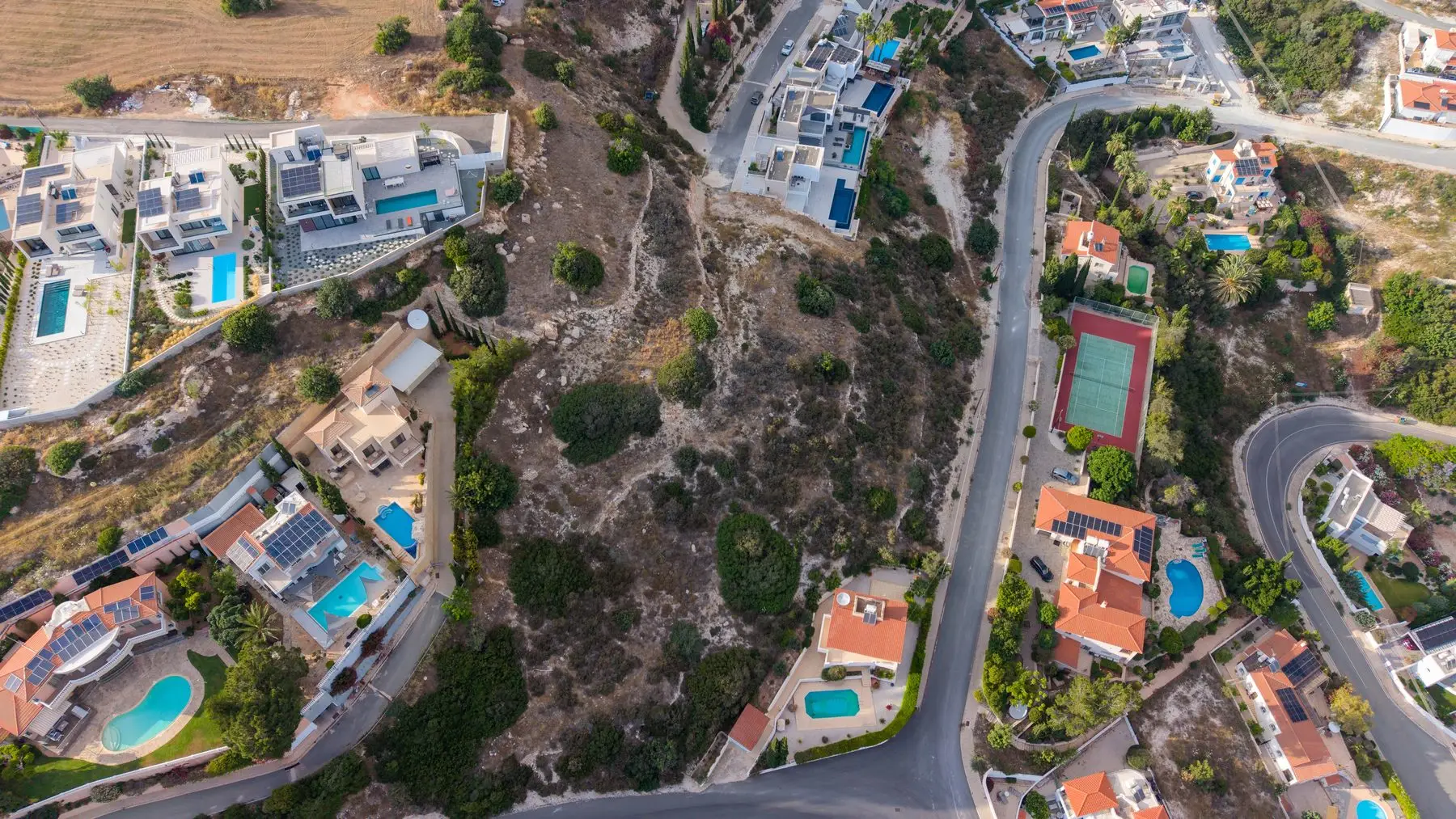
A top-down plot capture — the raw material for an orthomosaic map you can measure distances and areas on.
How does a drone survey work, step by step?
From first email to files in your inbox, a straightforward survey follows the same five steps:
Brief. You tell us what question the survey needs to answer — "what condition is this roof in?", "how big is this plot really?", "how far has the build progressed?". The question determines the flight, not the other way round.
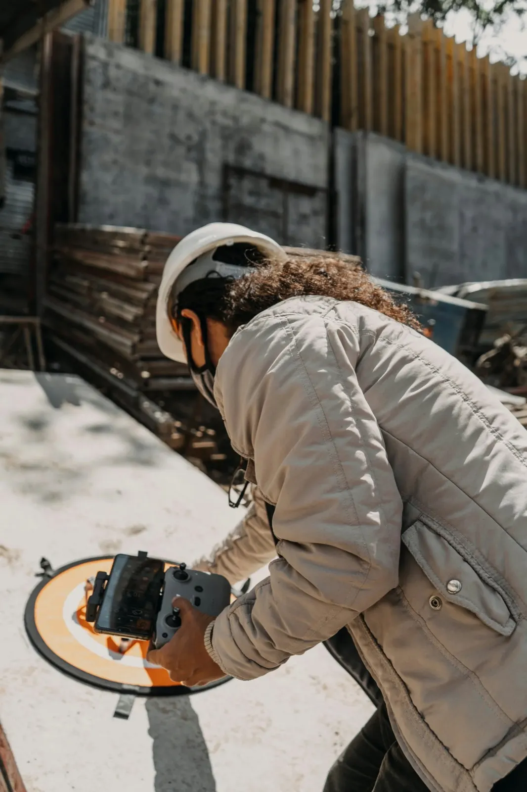
Flight plan and permissions. The pilot checks airspace restrictions, secures any required permissions, confirms weather windows and designs the flight pattern — grid for mapping, orbit and close-range passes for buildings.
Capture. The flight itself is the short part: usually 20–60 minutes on site for a typical plot or roof. In our experience the biggest time saving is here — we've flown everything from single roofs to whole hillside plots, and even the larger sites take longer batteries, not longer schedules.
Processing. Raw images are graded, annotated or stitched. This is where an orthomosaic, elevation model or condition report actually gets made — and where most of the skilled hours sit.
Deliverables. You receive the agreed outputs — photos, video, maps, reports — typically within 48–72 hours of the flight for photography and inspection work; large mapping jobs can take a few working days.
What does a drone survey cost?
Most providers won't tell you — the majority of drone survey websites we reviewed publish no prices at all and push you to a quote form. Here's the actual market context.
In the UK, one of the few firms publishing rates (Sky Scan Surveys) lists drone roof inspections from £349, topographic surveys from £599, and LiDAR or measured building surveys from around £1,199. US pricing guides put small-site surveys (under about 4 hectares) at roughly $200–$800, rising to several thousand dollars for large or high-accuracy LiDAR work. The drivers are the same everywhere: site size, accuracy requirements, deliverables and how often you need the data recaptured.
In Cyprus, our own published launch pricing looks like this:
Two honest caveats. First, "from" means from: a large site, difficult access or a fast turnaround moves the number. Second, cheap and expensive surveys often fly the same drone — you're paying for planning, processing and the judgement of the person interpreting the imagery, so compare deliverables, not just headline prices. Our full price list is on the services page.
— CyprusDroneX · Drone survey services
Need a drone survey in Cyprus?
Land, roof, building and site surveys flown by licensed pilots across the Republic of Cyprus, with results in 48–72 hours.
The comparison most people are really making is against traditional access: a surveyor with a ladder, a scaffold tower, a cherry picker, or a ground team walking a site with instruments.
The most expensive part of a traditional roof survey is rarely the surveyor. It's getting a human being safely up to roof height and back down again.
— why drones changed inspection economics
Safety is the clearest win: nobody climbs anything, so the working-at-height risk simply disappears. Speed follows — a roof that would take half a day with tower access is photographed in under an hour, and industry figures suggest drone capture runs several times faster than ground methods on open sites. Cost tracks both of those: no scaffold hire, no access equipment, no second visit because the light was wrong. And repeatability is the quiet advantage — a saved flight plan means the next survey is captured from identical positions, which is what makes month-on-month comparison genuinely useful.
Traditional methods keep the edge where contact or legal standing matter: physically lifting a tile, drilling a moisture reading, certifying a boundary, or surveying interiors. Which brings us to the honest section.
When do you actually need one?
The situations where a drone survey earns its fee, in the order we're most often booked for them across Cyprus:
Buying land. Photos from the road tell you almost nothing about a plot's shape, slope, access or neighbours. An aerial survey — ideally with an orthomosaic — shows you exactly what you're buying before you commit.
A pre-purchase roof check. The roof is the most expensive surprise in most property purchases and the hardest part to see. A drone roof inspection documents its condition in an afternoon, without a ladder.
Monitoring a build — especially from another country. Regular flights from fixed vantage points give you a truthful visual record that doesn't depend on the contractor's camera angle.
Boundary and context questions. Where does the plot actually end relative to that wall? A measurable top-down map turns arguments into measurements (see the legal caveat below).
Insurance documentation. Time-stamped aerial imagery before and after a storm, fire or dispute is the kind of evidence loss adjusters act on quickly.
What a drone survey can't do
This is the section most providers skip, so let's be direct. When a client asks us whether a drone survey is enough on its own, we tell them the truth about where it stops.
A drone survey is not a RICS building survey or its equivalent. We can show you a cracked tile, ponding water or a sagging ridge line in sharp detail, but we can't lift the tile, probe the timber underneath or certify structural adequacy. A drone building survey is evidence, not a professional structural opinion.
Nor is a drone map a legally binding boundary determination. An orthomosaic will show you where the fence sits relative to the plot with real-world accuracy, which is often enough to settle a practical question — but only a licensed land surveyor can produce a boundary plan that stands up legally.
Drones also can't see inside or underneath: interiors, foundations, buried services and anything under dense tree cover are out of reach, and weather can delay a flight by a day or two.
The right way to think about it: a drone survey pairs with surveyors, engineers and lawyers rather than replacing them. It gets the evidence cheaply and safely; they supply the certified judgement. The combination is usually cheaper and faster than the traditional route alone.
Who can fly one legally?
Commercial survey work requires a certified pilot, aviation-authority registration and insurance — not just a drone.
Not anyone with a drone. Commercial survey flights must be carried out by a certified, registered operator complying with the national aviation authority — the Department of Civil Aviation (DCA) in Cyprus, the CAA in the UK, EASA rules across the EU. In practice that means pilot certification, operator registration, insurance, and airspace or location permissions arranged before take-off, particularly near airports, towns and controlled zones.
Why should a client care? Because an unregistered flight can void the insurance value of the imagery, create liability that lands on the property owner, and in sensitive areas attract real penalties. Before booking any provider, ask two questions: are you registered with the aviation authority, and are you insured for commercial operations? A professional will answer both in one line. We fly as a licensed, insured operation across Cyprus — and put that in writing on every quote.
Frequently asked questions
How much does a drone survey cost?
UK published prices start around £349 for roof inspections and £599 for topographic surveys, with LiDAR and measured building work from roughly £1,199 — though most firms only quote on request. In Cyprus, our inspections start from €149, plot photography from €149, orthomosaic mapping from +€299 as an add-on, and construction monitoring from €129 per flight. Site size, accuracy and deliverables move the final number.
How long does a drone survey take?
The flight is usually 20–60 minutes for a typical plot or roof. Deliverables take longer than the flight: expect edited photos and inspection reports within 48–72 hours, and stitched maps or 3D models within a few working days on larger sites.
Is a drone survey worth it?
If your question is visual or measurable — condition, progress, size, layout, damage — almost always, because the alternative involves access equipment, height risk or guesswork. If your question is structural or legal, the drone survey is worth it as evidence for the professional you were going to hire anyway, not as a substitute for them.
Do building surveyors use drones?
Yes, and increasingly by default for roofs and high façades. The surveyor commissions the flight, we capture the imagery safely from the air, and their professional report is built on better evidence than a ladder-and-binoculars inspection could gather.
What's the difference between a drone survey and an orthomosaic?
A drone survey is the service; an orthomosaic is one possible deliverable of it — a single to-scale, top-down map stitched from hundreds of overlapping photos. We've written a full plain-English explainer on what an orthomosaic map is if you're weighing one up for a land purchase.
Do I need permission for a drone survey?
You don't — your operator does. Registration with the aviation authority, pilot certification, insurance and any airspace permissions are the provider's responsibility and should be sorted before the flight is even scheduled. If a provider is vague about any of these, choose another provider.
Still not sure which type you need? Tell us what you're trying to find out — we'll tell you honestly whether a drone survey answers it, and quote within one working day.
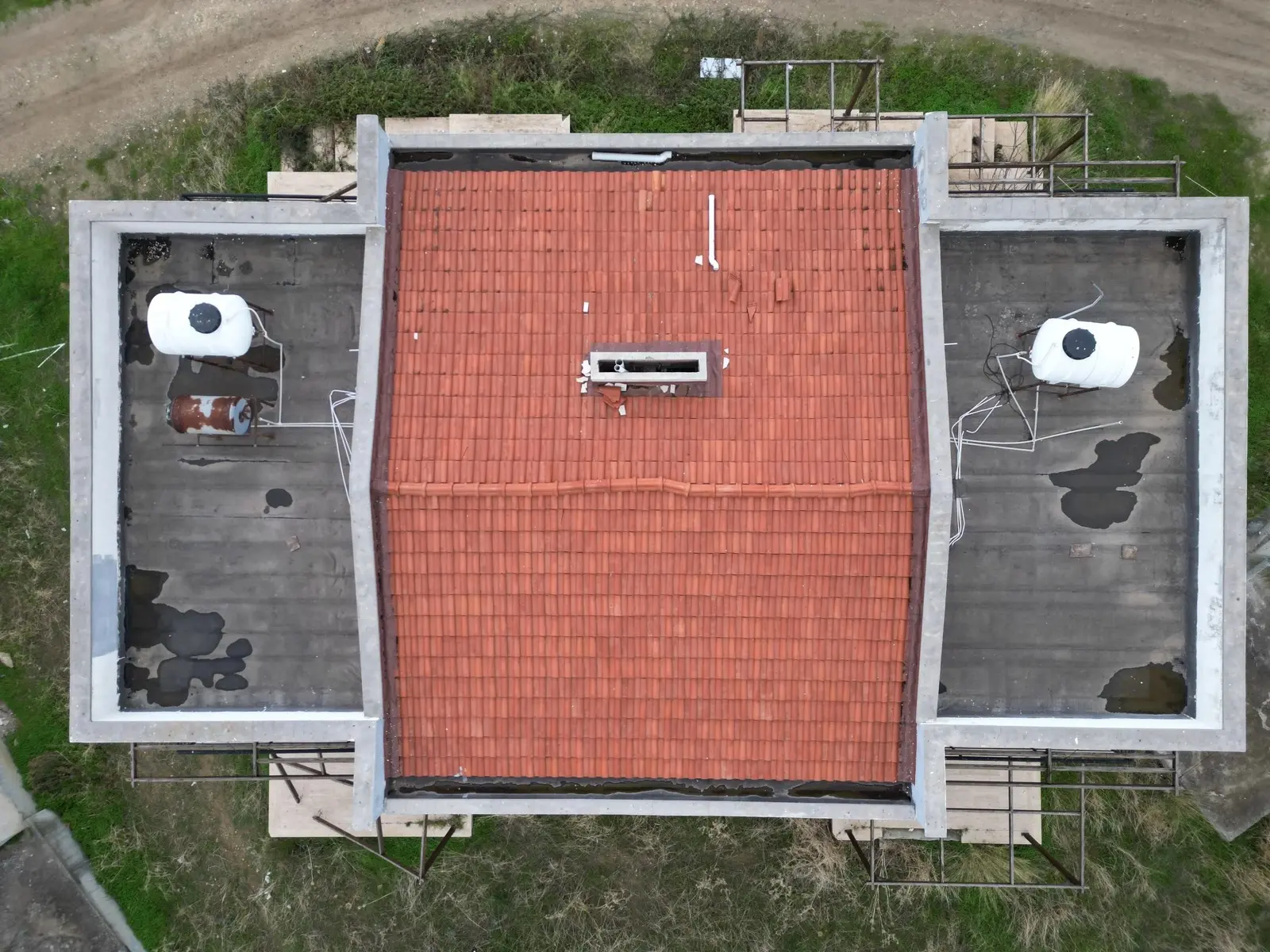
Close-range imaging that finds the cracked tile before it becomes a ceiling stain.
See what a drone survey can do for your site
Browse our full range of land, roof, building and construction-monitoring surveys — flown by licensed pilots across Cyprus, with fixed pricing and results in 48–72 hours. Prefer to talk it through? Tell us the question and we'll recommend the right survey.