cyprusdroneX · Nicosia · Cyprus
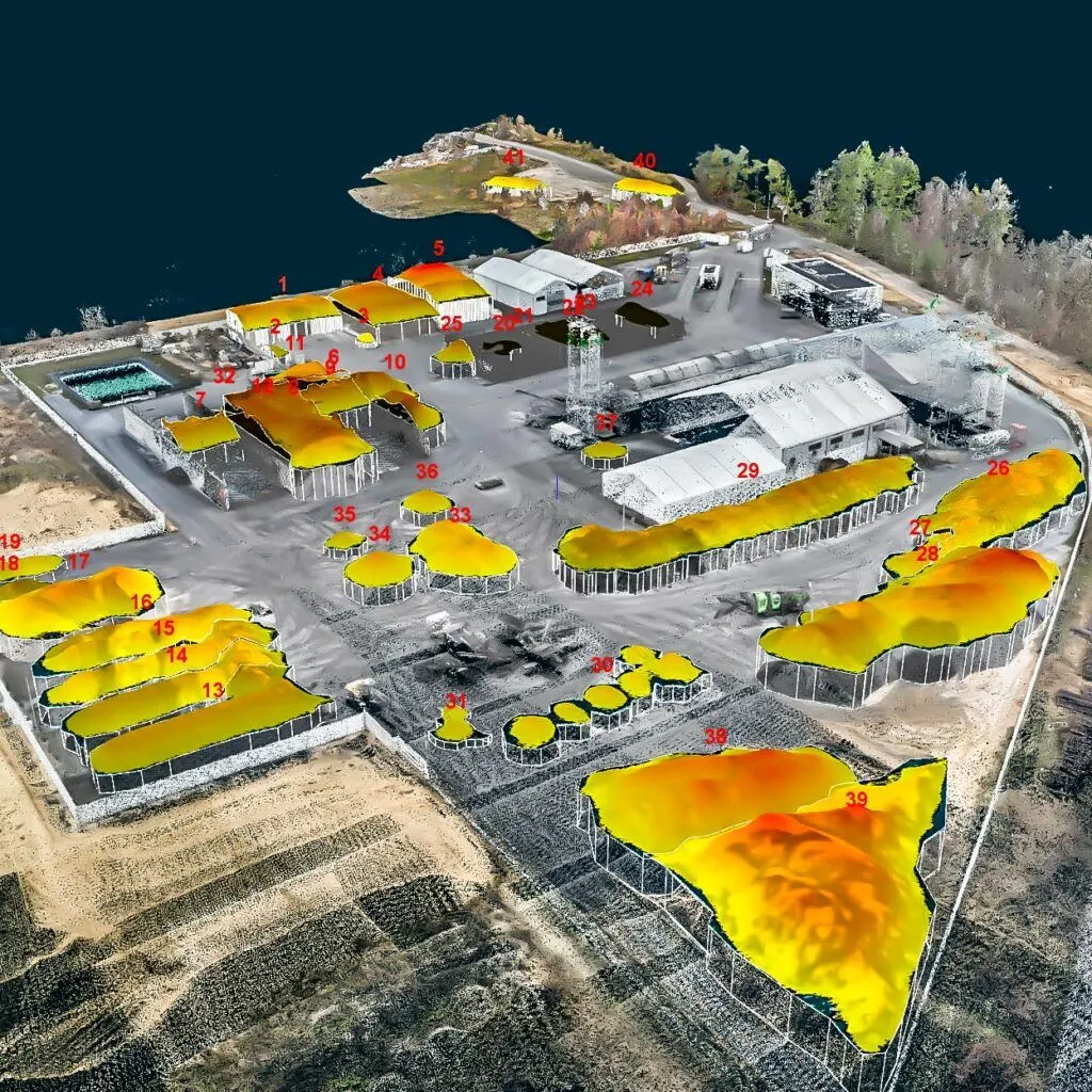
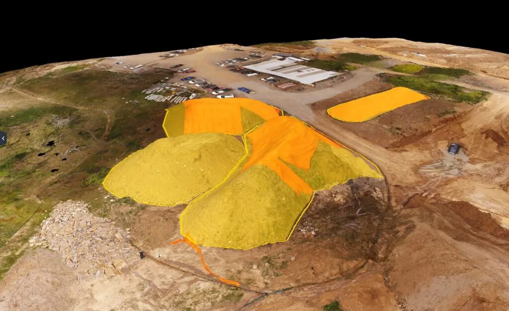
Drone stockpile volume model with measured surfaces on a working site
Home / Services / Earthworks & Stockpile Volumetrics
Commercial & Industrial · Volumetrics

Earthworks & stockpile volume surveys.

Volume figures that survive an audit — cut/fill against your design surface, month-on-month stockpile variance, and inventory reconciliation, each with a stated methodology and confidence interval.

Volume confidence
±1–2% typical
Accuracy
1–2 cm RTK
Outputs
audit-ready report
Coordinates
CGRS93 / LTM or your CRS
— 01 / The operational problem

Guesswork on what's actually on the ground costs real money.

Cost

Mis-measured volumes

Stockpiles and earthworks estimated by eye or truck-count drift from reality — you over-order, under-bill, or carry inventory that isn't there.

Delay

Surveying stops the pit

A crew on foot across an active quarry or fill area is slow and unsafe, and the site often has to pause around them.

Risk

Numbers that don't hold up

At audit, reconciliation or a client dispute, a volume with no stated method and no confidence interval is hard to defend.

— 02 / Deliverables specification

Exactly what you receive — with the numbers.

Every survey is delivered as auditable figures backed by the data behind them — not a single number you have to take on trust.

Output
Format
Detail
Volume report
PDF · CSV
Cut/fill and stockpile quantities with method and confidence interval.
Cut/fill against design
GeoTIFF · DXF
Your design surface differenced against the captured surface.
Surface model (DSM/DTM)
GeoTIFF · raster
Bare-earth and surface models of the working area.
Orthomosaic
GeoTIFF (.tif)
Georeferenced site image — GSD from 0.8 cm/px.
Point cloud
LAS / LAZ
Dense, RTK-referenced — recompute volumes in any survey suite.
Methodology & confidence report
PDF
Base surface, method and stated confidence.
Volume confidence
±1–2% typical
Absolute accuracy
1–2 cm H · 2–3 cm V
Revisit cadence
one-off or monthly
Coordinate system
CGRS93 / LTM or your CRS
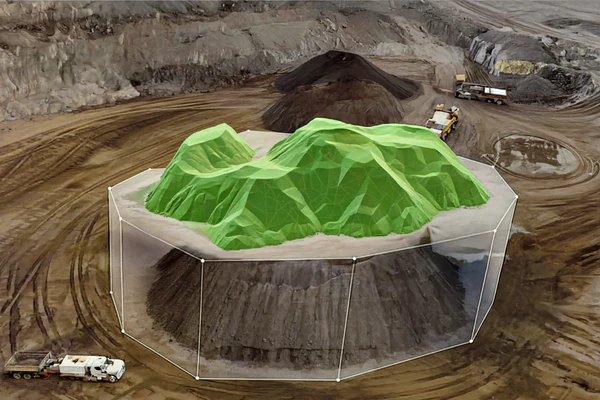
Drone photogrammetry stockpile with a green 3D volumetric surface overlay and bounding boxCut/fill surface
Drone-derived stockpile volume model with numbered, measured pilesStockpile volumes
— 03 / Methodology

Controlled capture, validated output.

01 · Plan

Flight & control plan

We set flight lines, altitude and overlap for your target GSD, and plan permit and geozone requirements before mobilising.

02 · Control

RTK positioning

The aircraft flies with an onboard RTK link, tagging every image with real-world coordinates as it is captured — so the survey is tied to a coordinate system, not just stitched imagery.

03 · Capture

Structured capture

Automated grid flight captures the full site at consistent overlap, with oblique passes where 3D reconstruction and vertical faces require them.

04 · Process

Photogrammetric processing

Imagery is processed into orthomosaic, DSM/DTM, point cloud and mesh, referenced to your coordinate system.

05 · QA

Positioning QA

The processed dataset is quality-checked for RTK positioning consistency, and the deliverable carries a stated accuracy figure.

06 · Deliver

Formatted delivery

Outputs are exported to your required formats and delivered via secure download, with the methodology report alongside.

— 04 / Capability

Technology that makes the data measurable.

We fly state-of-the-art, survey-grade equipment — but what matters to you isn't the hardware, it's that the output is accurate, verifiable and ready to build from.

Real-world RTK positioning and a survey-grade processing workflow are what separate measurable data you can build on from imagery that only looks precise.

Positioning
RTK · real-world coordinates
Accuracy
1–2 cm RTK
Detail
high-resolution capture
Outputs
CAD & GIS-ready
— 05 / Compliance & credentials

Cleared to fly on your site — and insured to be there.

Registered operator

Registered drone operator with the Cyprus Department of Civil Aviation (DCA), operating under the EASA regulatory framework.

Certified remote pilot

Current remote pilot competency for the relevant operational category, with documented flight procedures.

Operational authorisations

Open and Specific category operations as the site requires, with risk assessment for controlled or complex sites.

Third-party liability

Third-party liability insurance in place for commercial operations — cover level and certificate provided on request.

Geozone & permits

We handle airspace geozone checks, authorisations and any site-specific permits before the flight.

Data handling

Your site data is held securely and shared only with you and parties you nominate. NDAs accommodated.

— 06 / Scope & engagement

How a volumetric survey is scoped and quoted.

Single volume survey

A one-off capture of stockpiles or earthworks — a baseline count or a point-in-time reconciliation.

Monthly reconciliation

Regular captures for inventory reconciliation and month-on-month variance on an active site.

Per-site retainer

A standing agreement for a quarry or yard, with agreed rates, priority scheduling and consistent reporting.

To quote accurately, we need:

  • Site location and approximate working area
  • What you need measured (stockpiles, cut/fill, inventory)
  • Your design surface, if differencing against it
  • Required coordinate system
  • One-off, or a recurring reconciliation schedule
Request a scope & quote
— 07 / Sector applications

Who we measure for.

Quarries & aggregates

Stockpile inventory and extraction volumes for production and reporting.

Civil contractors

Cut/fill against design and earthwork quantities through the job.

Waste & recycling

Airspace and material volumes for cells, tips and processing yards.

Bulk material yards

Fast, safe stock counts across large open storage areas.

— 08 / FAQs

Technical & procurement.

Need something specific for a tender or spec? Send it over — we'll answer directly.

Request a scope
How accurate are your volumes?

Typically within ±1–2% of the true volume, depending on surface complexity and material. Every report states the base surface, method and confidence interval, so the figure is defensible.

What do you measure volumes against?

Against your design surface, a prior capture, or a computed base plane for stockpiles — whatever the reconciliation requires. We confirm the basis before we fly.

Can the figures be audited?

Yes — that's the point. The report documents the base surface, method and stated confidence, so the numbers hold up at audit and reconciliation.

Do we need to stop work on site?

No — we capture over an active site from the air. We coordinate brief safety measures with your team, but the pit or yard keeps running.

Which formats and coordinate systems do you deliver?

Reports as PDF/CSV, surfaces and orthomosaics as GeoTIFF, cut/fill as DXF, point clouds as LAS/LAZ — in CGRS93 / Cyprus LTM, UTM 36N or your CRS.

Are you insured and authorised to fly commercially?

Yes — registered with the Cyprus DCA, certified remote pilot, and covered by third-party liability insurance. We handle airspace authorisations and site permits. Certificates are provided on request.

— 09 / Commercial & industrial services

More from the commercial tier.

Know exactly what's on the ground.

Send the site and what you need measured. We'll come back with a scope and quote within one working day.

Request a scope & quote
Get in touch